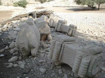
Public Relations Office of the Research Institute of Cultural Heritage and Tourism (RICHT) quoted Ahmad Sarkhosh, head of the probing operations as saying that the city of Mohr is located in the southernmost point of Fars Province with four sections.
Referring to the focus of the recent archeological studies on the western parts of the plain, he said studies had to be conducted in a radius of two km for probing operations to determine the limits and propose the privacy in the ancient Tole Pir site and for understanding the peripheral landscape of the area.
Referring to the implementation of studies in the form of archeological landscaping, Sarkhosh said first the aerial photos taken by the Geography Organization of the Armed Forces were prepared, the oldest of which belong to about the year 1335 (1946-47).
Prior to conducting any field operation, aerial photos were prepared, carefully studied and evaluated, but many of the old signs visible in the old pictures do not exist today; however, along the Mohran River a circular-shaped phenomenon could be seen, he added.
He went on to say that the total old and new images show several embankments connected with each other covering an area of several hundred hectares which due to agricultural activities a large part of the connected embankments have been leveled today.
Sarkhosh noted that in fact the embankments show a complex of a big city which, according to the surface works, belongs to the Parthian, Sassanid and up to the Middle Islamic era.
The historical texts and evidence show that the city of Koran has been considered as one of the most important cities of Siraf hinterland and during the Parthian and Sassanid periods had been the place of residence of the local princess of Pars, he noted.
9376**2050
Follow us on Twitter @IrnaEnglish
 solhkhabar | Peace International News Agency Peace International News Agency , Peace News , International Agency News of Peace