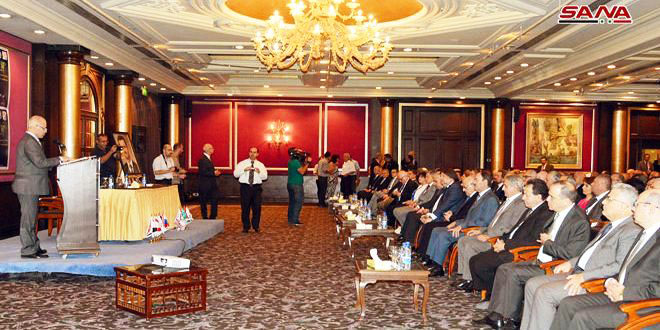
Al-Zafir remarks came at the opening of the 18th International Scientific Conference on Remote Sensing under the title of “The Role of Remote Sensing and Systems in the Rebuilding and Reconstruction Stage” after eight-year hiatus, SANA reported.
The minister underlined the need to identify available resources and their different structures to plan and manage them and monitor inaccessible places to obtain data.
For his part, General Director of the General Authority for Remote Sensing Haitham Mneini said that the Conference is necessary to back the efforts in the reconstruction stage, adding that damage must be assessed as a basis for rehabilitating damaged areas and agricultural lands that have gone out of service.
He also stressed the need to focus on the issue of regional planning where remote sensing and remote systems are the most important tools.
Speaking to SANA, Mohamed Ayari, President of the Tunisian Association of Digital Geographic Information and President of the Euro-Arab Union of Geomatics said that the conference is a great achievement under the current circumstances in Syria.
He pointed out that Tunisia has been building partnership relations with the Syrian Remote Sensing Authority for over 15 years, adding that he is participating in the conference through a series of researches and studies related to the use of remote sensing in the reconstruction stage in affirmation of supporting Syria for breaking the scientific siege imposed on it.
The conference is held by the General Authority for Remote Sensing at Dama Rose hotel in Damascus with the participation of Arabs and foreigners experts.
The participants in the three-day conference will discuss topics on remote sensing in regional and environmental planning as well as its role in appraising the needs of natural and agricultural resources and assessing crisis-related damages.
The conference was attended by Minister of Tourism Bishr Yazigi, Culture Minister Mohammed Al-Ahmad, assistants of a number of ministers, representatives of international organizations, a number of ambassadors from Arab and foreign countries and a host of officials and specialists.
The General Authority for Remote Sensing was established in 1986 to keep abreast of modern technologies and transfer them in accordance with developmental needs.
1396**1396
Follow us on Twitter @IrnaEnglish
 solhkhabar | Peace International News Agency Peace International News Agency , Peace News , International Agency News of Peace